“A surprisingly large number of the world’s cities remain unmapped. Nobody knows exactly how many, but cities of more than a million people in the developing world get by every day without an accurate map. Development staff in those cities trade photocopies of photocopies, scrawl the names of landmarks on post-it notes, use satellite images that lack street names, or just ask locals.”
—Chris Michael, The Guardian, 6 October 2014
Many of us, myself included, take accurate street maps for granted. Although we know services such as Google Maps can be wrong, generally our GPS or satnav will get us to where we want to go. But in many less affluent, large cities of the world, no maps exist.
An article I read in The Guardian recounted the difficulties that Médecins Sans Frontières (MSF) has encountered in working with patients from areas that weren’t mapped. It is hard to trace the spread of a disease if there is no map of the area, or if patients can’t tell you where they live.
There is, however, an exciting, innovative project to create a free and open map of the entire world. Missing Maps works through a team of volunteers to map the most vulnerable places in the developing world. “The point of the project is that the maps will all be open source,” says Missing Maps coordinator Pete Masters. “It will be illegal for anyone to charge anyone to use them—meaning local people will have total access to them, not just to look at, but to edit and develop.”
Missing Maps supports the OpenStreetMap project, which features local knowledge and a community of volunteer-contributors from a diversity of fields that includes professional cartographers as well as enthusiastic mapping amateurs. According to the Humanitarian OpenStreetMap Team (HOT) website: “OpenStreetMap is a project to create a free and open map of the entire world, built entirely by volunteers surveying with GPS, digitizing aerial imagery, and collecting and liberating existing public sources of geographic data. The information in OpenStreetMap can fill in the gaps in base map data to assist in responses to disasters and crisis.”
Why is this important? The lack of accurate maps in a humanitarian crisis can impede assistance, and even hinder the making of decisions about the best response. That’s where the Humanitarian OpenStreetMap Team (HOT) comes in—they act as a “bridge” between the OpenStreetMap Community and humanitarian responders. In the event of a crisis, HOT searches for existing data and then contacts humanitarian organizations responding to the crisis to determine their needs. This is a critical function, as HOT can then mobilize their community to focus on a specific area.
HOT can both coordinate remote workers for map digitalization and also train locals in mapping their communities. Having maps available will assist not only in times of crisis, but also in planning for building new infrastructure. Here is a visualization of the response to the earthquake in Haiti by the OpenStreetMap community.
I was struck at how this “bridging” done by HOT is so similar to the cultural bridging people learn through the Cultural Detective Method. It is like there are two cultures: the “mappers” and the “responders”—each with its own values, behaviors, and communication styles. What HOT does is to make sure the “mappers” are meeting the needs of the “responders” in a way that enables responders to understand and use the information. Both have good intentions, but without the “bridge” HOT provides they might never connect, let alone connect in a way that is so beneficial.
Often, people who are able to build cultural bridges are looked at by others as resources. What many people don’t realize is that sometimes the person adept at building bridges across cultural divides does not have culture-specific knowledge on which to rely. Rather, they have a set of skills that facilitates communication, beginning with suspending judgment and listening.
That’s the kind of resource HOT is. It doesn’t tell the responders where to go or what to do. It asks humanitarian organizations what maps and data they need to do their jobs, listens to the answers, and then this amazing group of volunteers gets to work. To learn more about this project, please read the entire article here.
And join us to learn more about the Cultural Detective Method and developing skills to build cultural bridges. Remember, we host free monthly webinars to get you started—access registration information here.

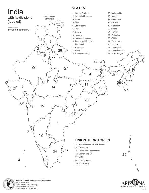
 Do you work with people from an area of the world you know little about? Most of us aren’t that great at the geography of our own area of the globe, to say nothing about knowing the names of states, cities, or rivers half a globe away! It can be awkward when chatting with a colleague in another country and they talk about their weekend travels, but you have absolutely no idea whether they went to a city, the country, mountains, or seashore. Not the best way to build credibility! Even worse if your colleague is talking about organizational expansion plans, and you don’t know whether they’re talking north, south, east, or west! Learning some basic geographical literacy can be a great help in building relationships, trust, and productivity on a team.